
Holland Township ZIP Code Coverage
Official state ZIP reference material places 49423 and 49424 around Holland. Holland Charter Township’s own offices use 49424, and the county sample parcel also uses that postal code. Neither fact turns the whole township into one postal zone. The research did not locate a verified street-by-street ZIP boundary list for the township, so an exact address must be checked through USPS. Postal lines can also reach the City of Holland, Park Township, Olive Township, or other nearby government units.
| ZIP | Areas Covered | Post Office | Notes |
|---|---|---|---|
| 49424 | Holland postal area, including substantial Holland Charter Township portions and nearby Park, Olive, and Port Sheldon areas | Holland, MI 49424; verify the address-specific facility through USPS | Standard ZIP. Township offices and the documented sample parcel use 49424; it crosses municipal lines. |
| 49423 | Holland postal area, including parts of the greater Holland area and nearby township land | Holland, MI 49423; verify the address-specific route through USPS | Standard ZIP. It may appear outside the City of Holland. |
| 49422 | Holland postal or PO-box and delivery references; Holland Township parcel coverage was not located in official sources | Holland, MI 49422 | Do not assign it to a township parcel without an address-specific USPS result. |
| 49460 | West Olive, Ottawa County | West Olive post office | County-office mailing area, not a general Holland Township parcel ZIP. |
The useful distinction is coverage, not a promise of municipal precision. For Holland Township, the parcel card’s Government Unit field supplies the jurisdiction check after the postal code narrows an address. County office mail can use a nearby ZIP without making the office or the record a Holland Township address.
Holland Township ZIP Code Checks
USPS is the authority for the standardized mailing form and the ZIP or ZIP+4 tied to a particular address. Enter the full street address instead of relying on a neighborhood name, a city label in an old record, or an online map pin. The result helps normalize street suffixes and directions before a written request or a county property search. It does not confirm that a place lies inside Holland Charter Township, and it does not supply a historic postal boundary for an older directory entry.
USPS ZIP Code Lookup is the address-specific route for a standardized result.
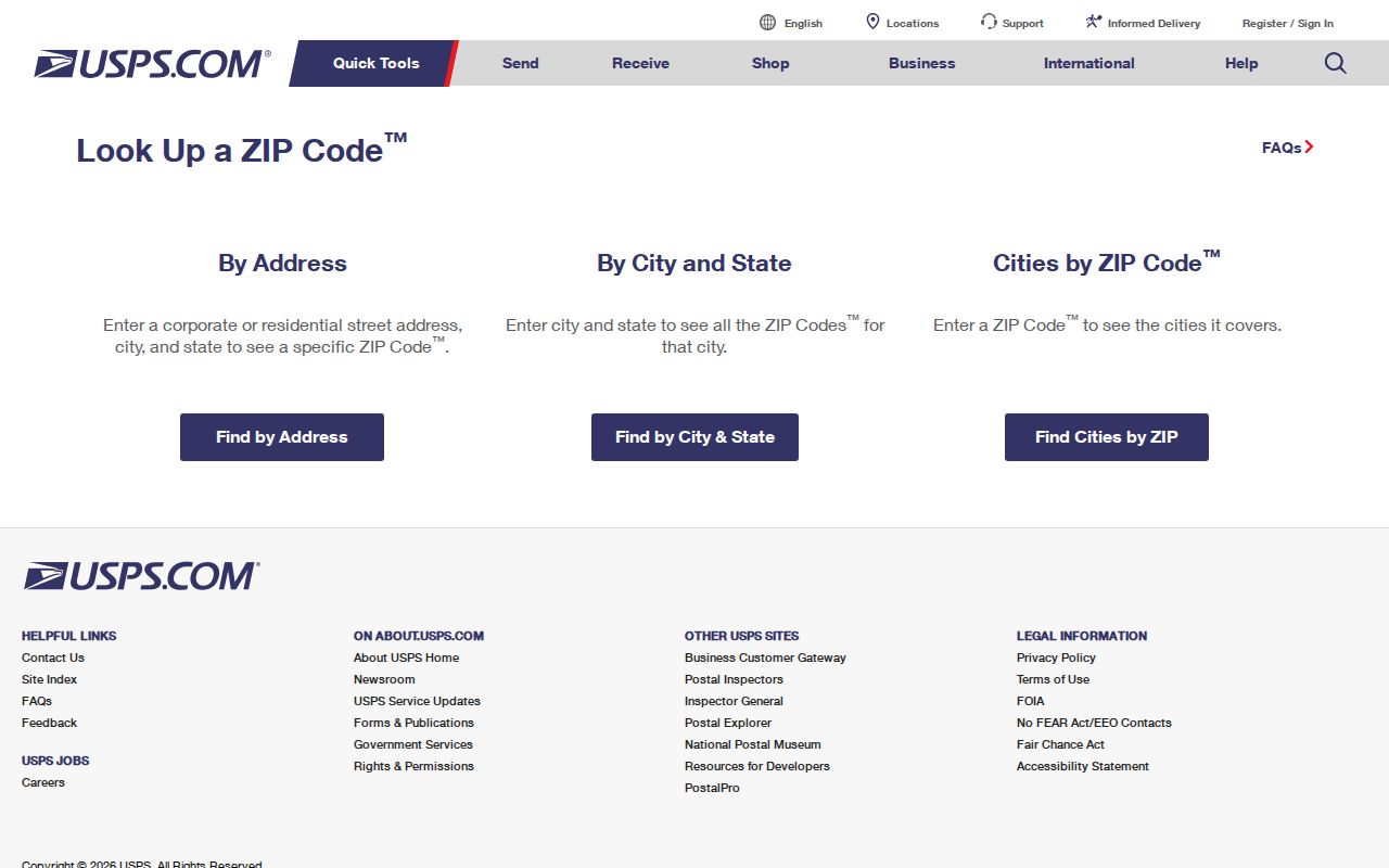
Use the returned spelling and postal code when searching a current parcel or mailing a records request. Preserve an older street spelling in historical research too, because a modern USPS form cannot bridge a former route or community label by itself.
Holland Township ZIP Code GIS Fields
Ottawa County’s public parcel layer adds a useful second filter. It includes both PropertyZip and MailingZip, alongside the property address, mailing address, parcel identification, government unit, school district, legal description, classification, values, acreage, and principal-residence-exemption field. Those ZIP values can differ just as the property address and correspondence address can differ. A mapping result is a geographic lead, while the property card is the better place to verify the parcel details.
Ottawa County Real Property Search offers owner, parcel-number, and house-number plus street-name searches, but its basic form does not expose a ZIP search field. The county parcel GIS carries the ZIP attributes instead.
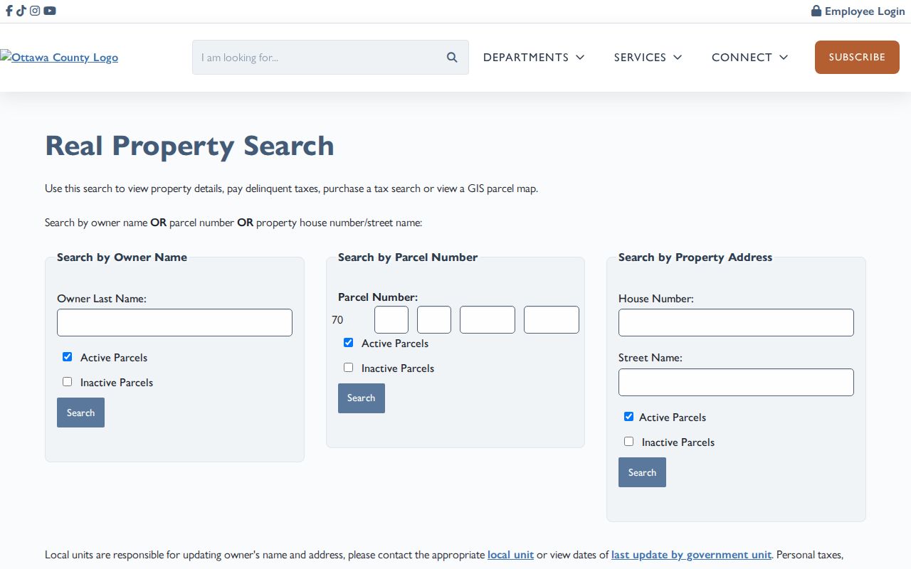
After locating a parcel by its standardized address, check the property address, mailing address, and Government Unit separately. The documented Holland Township sample PIN begins 70-16-06-106-011, but a PIN is a parcel key, not a ZIP code or a proof of who is currently present there.
Note: The county map is countywide, so filter results by both ZIP attributes and Government Unit before calling a result part of Holland Township.
Searching Holland Township ZIP Codes
ZIP-focused work is most accurate when it follows the access channel suited to the question. USPS standardizes the address. The county GIS can filter property and mailing ZIP attributes. The property form then opens a parcel by street, owner, or PIN. Michigan Voter Information Center uses a ZIP as one part of an individual registration match, not as a browse-all-residents tool. Each source answers a narrower question than “who lives in a ZIP,” and that limit keeps a postal search from becoming a misleading roster.
- Enter the complete address in USPS lookup and record the standardized street form and postal code.
- Search the county property form by house number and street name, or use the PIN when it is known.
- Use the county parcel layer’s PropertyZip or MailingZip attribute with its Government Unit field to find geographic candidates.
- Open each relevant parcel card and distinguish the physical property address from the owner’s mailing address.
- For a known person, use the ZIP with the other required Michigan voter fields rather than attempting a ZIP-wide voter browse.
- When the question becomes a particular road or address sequence, use the Holland Township street directory for the by-street record trail.
Michigan FOIA can be used to request an existing county or township record, but a request should identify a date range, parcel, document number, or case number. It should not ask a government office to create a new list of private people from scattered systems. The township Clerk handles local FOIA requests, while Ottawa County’s FOIA Center is the county route for account-based requests and record alternatives.
Holland Township ZIP Code Voter Match
The Michigan Voter Information Center uses ZIP only to help match one known voter. Its individual form requests first name, last name, birth month, birth year, and ZIP code. A successful result can confirm registration status, address information, and election information for the matching person. It is not a public street list or a household roster. The state says voter-registration records are public through FOIA with specific redactions, and the broader Qualified Voter File process is a separate written request with its own delivery and privacy rules.
| MVIC field | Type | Required | ZIP-related use |
|---|---|---|---|
| First Name | Text | Yes | Given name as registered. |
| Last Name | Text | Yes | Surname paired with the other fields. |
| Birth Month | Dropdown or text | Yes | Month only; month and day are not public. |
| Birth Year | Text or dropdown | Yes | Year used to narrow the individual match. |
| ZIP Code | Text | Yes | Postal code associated with the registration. |
| Search | Button | Yes | Returns voter information if the required fields match. |
Michigan Voter Information Center is the official individual lookup. Michigan excludes driver-license or state-ID numbers, month and day of birth, phone, email, digitized signatures, Social Security digits, and other protected fields from ordinary voter-record disclosure. Address Confidentiality Program material is also not produced as an ordinary address record.
Note: A voter match is registration evidence at a point in time, not proof that every person at an address is registered or currently present.
Holland Township ZIP Code Terms
Postal, parcel, and legal descriptions should not be swapped for one another. A postal designation helps delivery and address matching. A parcel record anchors a property in Ottawa County’s land system. A legal description identifies land through a lot and block, condominium unit and master deed, or metes-and-bounds language. The county parcel card brings these facts together, but each field keeps its own role in a search.
- ZIP code
- A postal delivery area. It is not a city or township boundary.
- ZIP+4
- An added four digits that narrow mail delivery beyond the basic ZIP. USPS supplies it for a specific standardized address.
- PO-box ZIP
- A postal designation tied to post-office boxes or related postal service. It should not be assigned to a township parcel without verification.
- Carrier route
- A mail-delivery route used for postal operations. It is not a legal land description or a resident roster.
- Situs address
- The physical property address used by the assessor, GIS, and permit systems, distinct from the owner’s mailing address.
Keep the source field with every result. A ZIP can guide a search, a situs address identifies the place, a mailing address identifies correspondence, and a legal description follows the land through recorded documents.
Holland Township ZIP Code History
ZIP codes are poor bridges for early household research. For an older address, preserve the street spelling, community name, parcel or legal description, and historical map context. The documented Holland-area sequence includes Kanter directories from 1894 through 1913-14, the 1908 Ottawa County Gazetteer, and the 1924-25 multi-community directory. Later Polk and Bresser volumes, assessor sales and split history, plats, deeds, and census geography can connect an address across periods when a modern ZIP cannot.
Holland Township’s documented 1856 Groningen road relocation is a genuine historical geography clue, but it is not a verified numeric street-renumbering project. Search Groningen and New Groningen as place names in directories, church records, maps, and atlases. The research did not locate an official township-wide renumbering list, so do not manufacture a modern address conversion from an old postal or road reference.
Note: Use the date and record type to bridge historical addresses, because a modern ZIP code rarely explains an older rural route or settlement label.
Holland Township ZIP Code Myth
A Holland ZIP is not the same thing as the City of Holland, and a city-label field is not a substitute for jurisdiction. Holland Charter Township is separate from the City of Holland. Holland postal addresses can also fall in Park Township, Olive Township, or another local unit. This is why the Government Unit field on the county property card is the decisive current-record check after USPS supplies a postal result.
Planning names such as Pine Creek, Creekside, Rose Park, New Groningen, Beechwood Vista, Westshore, Federal Square, and Adams Street are useful map clues from the township’s Unified Vision work. They are not ZIP boundaries, ward labels, legal subdivisions, or membership lists. Use them to orient a GIS search, then rely on the parcel, postal, and government-unit fields for a precise record trail.